Aphonopelma xwalxwal Hamilton, 2016
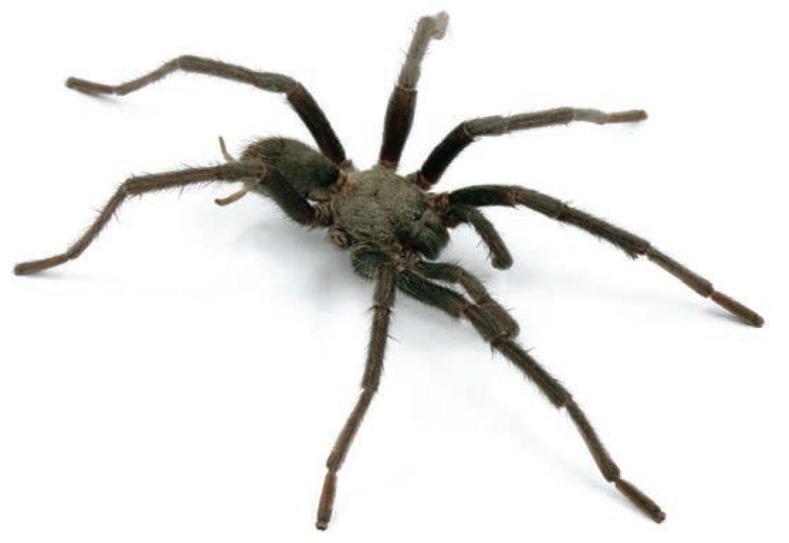
♀ Female described ♂ Male described

Type Locality and Records

Type locality

Distribution

USA

Type Locality: Hwy S22 (Montezuma Valley Rd), 3.3 miles S junction with Palm Canyon Dr. (Borrego Springs), Anza-Borrego State Park, San Diego Co., California

Adult Male Activity

Collection months of 14 adult male specimen records, against the rainfall where they live

WinterSpringSummerAutumn15832°11°JFMAMJJASOND8039mm0
Adult males collected

Of 14 adult males, 9 of 14 (64%) fall in the six wettest months, and 13 of 14 (93%) in the six warmest. Collections peak in October. The warmer half of the year is much the closer fit here.

Mean monthly rainfall and temperature 2001–2020 near the type locality. MERRA-2 via NASA POWER, for a grid cell averaging 1687 m. Northern hemisphere seasons.

Etymology

The specific epithet is a noun in apposition, referencing the word for “a type of small spider” in the language of the Cahuilla Native Americans, whose traditional territory includes the distribution of this species.

Pronunciation

Pronounced “hwalhwal”; xw - sounds like a light raspy sound when blowing out a candle; a - sounds like “a” in father; l - sounds like “l” in light.

Specimen Records (14)

APH_3133 ♂ Type USA

Hwy S22 (Montezuma Valley Rd), 4 miles S junction with Palm Canyon Dr. (Borrego Springs), Anza-Borrego State Park

October 2013 · col. Wendell R. Icenogle

APH_3134 ♂ Type USA

Hwy S22 (Montezuma Valley Rd), 3.3 miles S junction with Palm Canyon Dr. (Borrego Springs), Anza-Borrego State Park

October 2013 · col. Wendell R. Icenogle

AUMS_2668 ♂ USA

Deep Canyon

October 1963 · col. E. Schlinger

AUMS_2670 ♂ USA

P.L. Boyd Deep Canyon Reserve Center, 3.5 miles S of Palm Desert

October 1969 · col. Saul Frommer

AUMS_3319 ♂ USA

Carrizo Creek, .25 miles S of Hwy 74 (bridge), 4 miles S of Palm Desert or Hwy 111

March 1972 · col. W.R. Icenogle

AUMS_3318 ♂ USA

on Hwy 74, 2.5 (road) miles S of Carrizo Creek (bridge), 6.5 miles S of Palm Desert or Hwy 111

October 1976 · col. W. Icenogle

AUMS_2344 ♂ USA

P.L. Boyd Deep Canyon Reserve, at reserve gate - North

September 1995 · col. T. R. Prentice

AUMS_2345 ♂ USA

P.L. Boyd Deep Canyon Reserve, 0.5 miles below reserve gate

September 1995 · col. T. R. Prentice

AUMS_2348 ♂ USA

P.L. Boyd Deep Canyon Reserve, 0.4 miles N of reserve station

September 1995 · col. T. R. Prentice

AUMS_2352 ♂ USA

P.L. Boyd Deep Canyon Reserve, 1.1 miles below reserve gate

September 1995 · col. T. R. Prentice

AUMS_3280 ♂ USA

P. L. Boyd-Deep Canyon Reserve, 0.2 miles below reserve gate

September 1995 · col. T. R. Prentice

APH_3130 ♂ USA

Hwy S22 (Montezuma Valley Rd), 2.8 miles S junction with Palm Canyon Dr. (Borrego Springs), Anza-Borrego State Park

October 2013 · col. Wendell R. Icenogle

APH_3131 ♂ USA

Hwy S22 (Montezuma Valley Rd), 3.2 miles S junction with Palm Canyon Dr. (Borrego Springs), Anza-Borrego State Park

October 2013 · col. Wendell R. Icenogle

APH_3132 ♂ USA

Hwy S22 (Montezuma Valley Rd), 1.6 miles S junction with Palm Canyon Dr. (Borrego Springs), Anza-Borrego State Park

October 2013 · col. Wendell R. Icenogle